Photos show Ida’s devastating impact on coastal Louisiana from above
Louisiana’s coastal communities—a network of fisheries, oil and gas hubs, and wildlife refuges—saw catastrophic damage from Hurricane Ida.
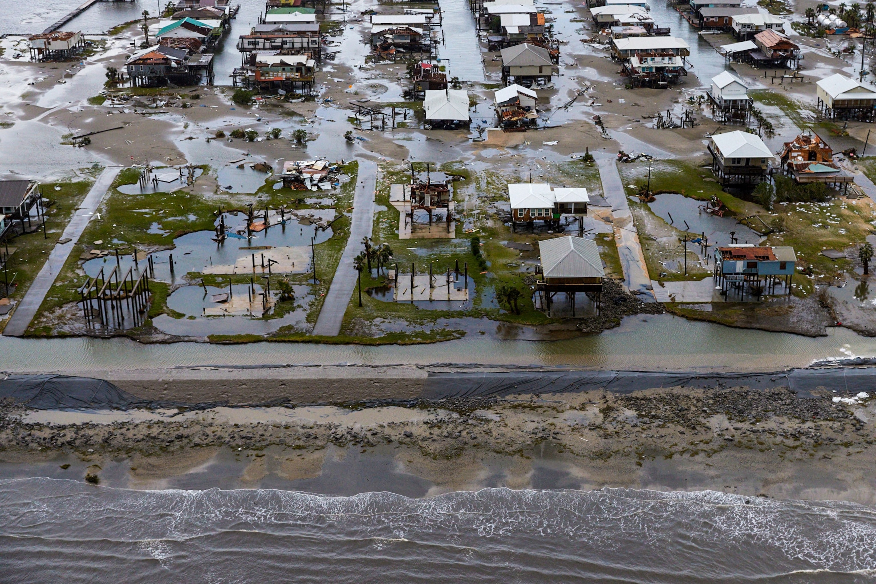
Some of the places hardest hit by Hurricane Ida’s Category 4 winds lie just south of New Orleans—a region of fishing villages, wildlife refuges, and oil and gas facilities. Once a site of healthy, expansive coastal wetlands, the region is now slowly eroding into the sea. It includes the Isle de Jean Charles, home to the Biloxi-Chitimacha-Choctaw Tribe, a community billed as the nation’s first climate refugees.
As Louisiana loses these wetlands at the rate of a football field per hour, it loses not only critical fisheries but also a buffer that protects New Orleans and other towns to the north from deadly storm surges coming off the Gulf of Mexico. Major hurricanes like Ida, in turn, hasten the demise of the wetlands.
National Geographic photographer Ben Depp, who lives in New Orleans, rode out the storm at home. After Ida passed and it was safe to fly once again, he took these photographs of the storm’s extensive damage from an airplane.


The National Geographic Society, committed to illuminating and protecting the wonder of our world, has funded Explorer Ben Depp's work. Learn more about the Society’s support of Explorers.


