Scientists reveal a hidden world beneath Antarctica's ice where rivers flow uphill
Unseen mountains, valleys, lakes, and rivers lie under Antarctica’s mile-thick ice sheet. Changes to those hidden rivers could have dramatic global consequences.
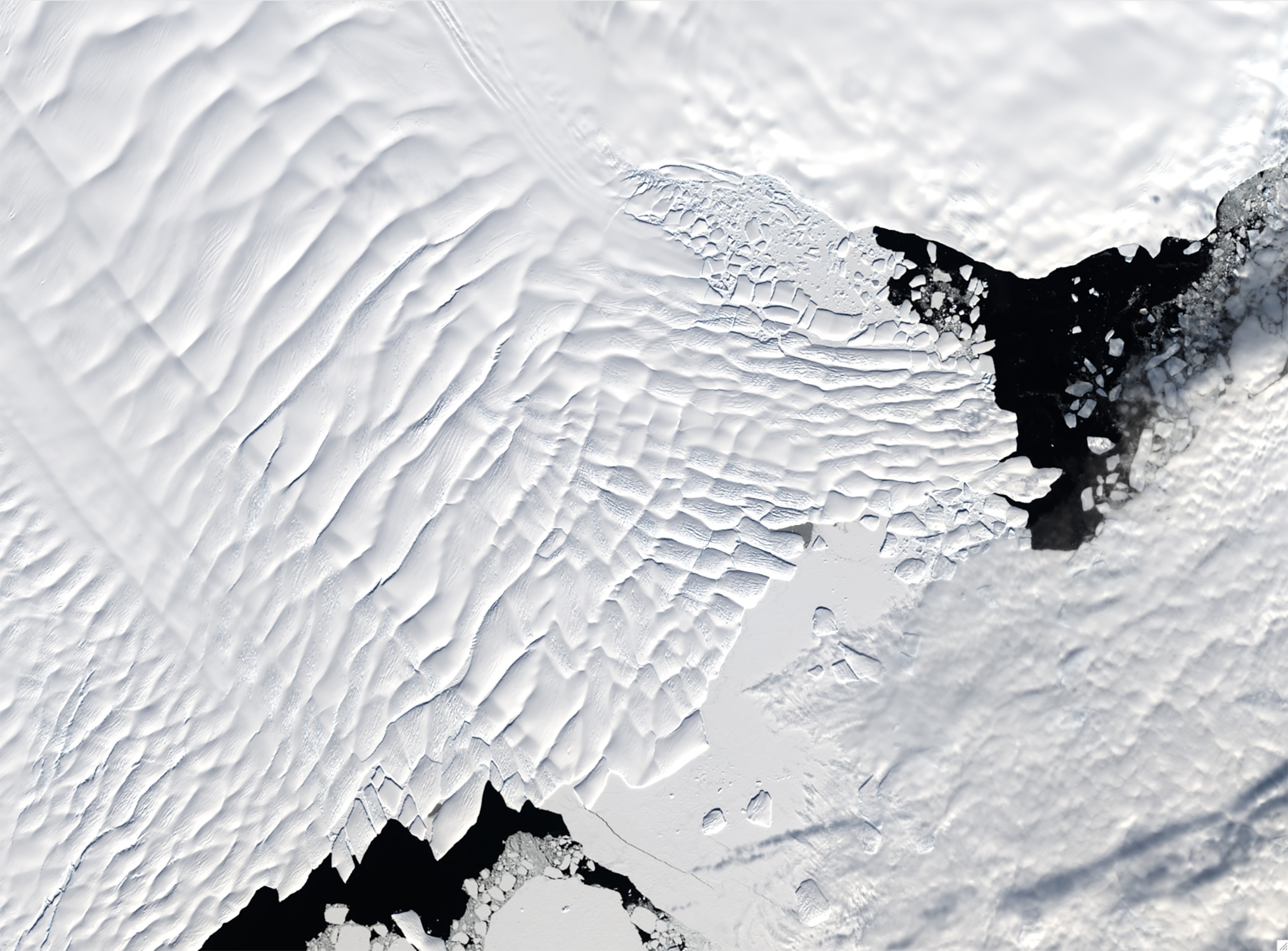
Antarctica’s massive ice sheet looks flat. Although the continent’s expansive layer of ice rises 13,400 feet above sea level near its center, the gentle slopes of that dome are imperceptible to the human eye.
But below that mile-thick ice lies something surprising: a landscape of steep mountains and valleys, traversed by meandering rivers. Those rivers could play a decisive role in how the ice sheet responds to unprecedented warmth.
Scientists now predict that as Antarctica’s ice sheet melts and thins over the next few decades, those hidden rivers will grow, jump their banks, and shift onto new flow paths. This could destabilize large coastal glaciers that control the rate of sea level rise.
“The changes are pretty drastic,” says Christine Dow, a glacial hydrologist at the University of Waterloo in Canada, whose team co-led the new study. These evolving rivers could cause glaciers to melt and slide more quickly into the ocean. “We are under-predicting how fast things are going to change and how much ice loss there’s going to be in the next 80 years,” she says.
These findings, published March 20 in Nature Communications, stem from 20 years of work to map the hidden continent cloaked beneath Antarctica’s ice sheets.
An unexplored world under ice
No human has ever seen these hidden mountains and valleys. But over the last few decades, planes have flown hundreds of lines crisscrossing Antarctica, using ice-penetrating radar and precise measurements of gravity and magnetic fields to peer under the ice.

LIMITED TIME OFFER
Those surveys found mile-high mountain ranges, broad valleys, and deep canyons. Radar also revealed the flat, bright reflections of several hundred subglacial lakes beneath. Those lakes are fed by water that slowly melts off the base of the ice sheet, a fraction of an inch per year, due to geothermal heat seeping from deep inside the earth, and from the friction of ice sliding over land.
Scientists also realized that subglacial rivers often flow in or out of the lakes. Those rivers can act in strange ways, since they obey not only gravity, but also the crushing pressure of the ice overhead, says Anna-Mireilla Hayden, a Ph.D. student in glacial hydrology who is on Dow’s team at the University of Waterloo.
“Water can actually flow uphill,” she says, from places where the ice overhead is thick and the pressure is high, to places where the ice is thinner and the pressure lower. In some cases, water can flow hundreds of feet up the steep sides of subglacial mountains.
These narrow rivers are hard to find with radar. So Dow’s team spent 11 years mapping the rivers in a more painstaking way. They combined maps of the subglacial landscape with precise measurements of the ice thickness to predict the routes that subglacial water will flow as it responds to gravity and pressure.
They found that most of Antarctica’s fastest-moving glaciers have plentiful water beneath them, lubricating the ice as it slides over land. This is especially true of the continent’s most unstable glaciers, the Thwaites and Pine Island glaciers, which are spilling ice into the ocean more quickly than ever. The landscape beneath these glaciers is studded with volcanoes and rift valleys that emit high levels of geothermal heat—and hence, lots of lubricating melt water.

Mysterious melt spots under the ice
With their new insights into Antarctica’s hidden rivers, they also helped solve a mystery.
Most of Antarctica’s coastline is fringed with slabs of ice, hundreds of feet thick, that float on the ocean. These floating ice shelves hold back coastal glaciers, slowing their flow into the ocean. Scientists knew that these ice shelves constantly melt from below, as their undersides are bathed in sea water a couple of degrees above freezing. But satellite measurements repeatedly showed something strange.
Many of these ice shelves have hot spots, a mile or more across, where they are melting several times faster than they should, based on the temperature of the sea water. In some cases, these hot spots are thinning the ice by 100 to 300 feet per year.
In 2020, a large team of researchers that included Dow reported an explanation.


Looking at Getz Ice Shelf on the coast of West Antarctica, they recently found that those rapidly melting spots occurred in the same places where they predicted that subglacial rivers were pouring out from under the edge of the ice sheet and into the ocean.
The water gushes out from under the ice like a high-pressure garden hose, Dow says.
As this fast-moving fresh water encounters the dense, salty seawater, it rises buoyantly—creating a turbulent, upside-down waterfall. That swirling, billowing waterfall lifts up a layer of warm, dense, salty water that normally hugs the seafloor, and pushes it up against the bottom of the ice, vastly increasing the rate of melt.
Hidden rivers start to roar
“You need the effect of this [subglacial] discharge in order to explain the observed melt rates,” says Jamin Greenbaum, a glacial geophysicist at the Scripps Institution of Oceanography in San Diego, who has spent 15 years mapping the landscape under Antarctica’s ice.
But the computer models that scientists currently use to project future ice loss and sea level rise don’t include these effects, says Greenbaum.
In 2024 Greenbaum, Dow, and her then-postdoc Shivani Ehrenfreucht reported that this river-driven melting would have a major impact on East Antarctica’s Totten Glacier, which by itself holds enough ice to raise sea level by 12 feet. They found that by 2100, subglacial rivers increased the ice loss from Totten by 30 percent over standard models.
“We were a bit surprised,” says Tyler Pelle, the post-doc who did much of the modeling in Greenbaum’s lab.
That experiment was only a rough approximation, because it assumed that the rivers wouldn’t change over time. But Dow thinks the rivers will change, because as ice thins, the changing pressures could cause rivers to shift. And as Totten slides more quickly, the increased friction could cause more melting.

Dow, Hayden, and Pelle took these experiments a step further in their new study: they allowed the rivers to evolve as Totten Glacier thinned and retreated. The results in their newly published paper are sobering.
They projected that by 2100, the amount of subglacial water flowing out from under Totten glacier would increase by nearly five-fold, reaching 5,700 cubic feet per second, about one quarter the current outflow of the Colorado River. They estimated that the speed of that subglacial water flowing into the ocean might also increase—potentially reaching a speed of roughly three feet per second—similar to many fast-flowing rivers in the western United States.
“The important thing,” says Dow, “is the speed that the water is being pushed out.” It will drive stronger turbulence when it hits the ocean—lifting more warm, salty water into contact with the ice.
Hayden, Dow, and Pelle estimated that the rate of melting and thinning would increase by 20 to 50 percent across a broad swath of the ice shelf.
That sort of increased melt in a focused area could be “hugely important,” says Karen Alley, a glaciologist at the University of Manitoba in Canada, who was not part of the current project. “That becomes a weak point in the ice shelf,” she says. The shelf may eventually break in that spot, “and you might lose that ice shelf sooner than you think.”
As our maps and estimates of geothermal heat improve, so too will our understanding of subglacial rivers, says Greenbaum.
“We’re probably vastly under-estimating the amount of water down there,” he says. Until the science catches up, “our projections of sea level rise are going to be too conservative.”


